|
|
|
|
|
|
|
|
 Tanegashima Geography Tanegashima Geography
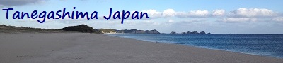
Tanegashima (種子島) is one of the Ōsumi Islands belonging to
Kagoshima Prefecture, Japan. The island, 444.99 km² in area,
is the second largest of the Ōsumi Islands, and has a
population of 33,000 people. Access to the island is by
ferry, or by air to New Tanegashima Airport.
Administratively, the island is divided into the city,
Nishinoomote, and the two towns, Nakatane and Minamitane.
The towns belong to the Kumage District.
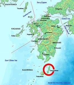
Picture - Map showing
the location of Tanegashima in relation to the main island
of Kyushu.
Tanegashima is the easternmost and the second largest (after
Yakushima) of the Osumi Islands. It is located approximately
43 kilometers (23 nmi) south of the southern tip of Osumi
Peninsula in southern Kyushu, or 115 kilometers (62 nmi)
south of Kagoshima. The Vincennes Strait (Yakushima Kaikyō)
separates it from Yakushima.
The island is of volcanic origin; however, unlike
neighboring Yakushima, it presents a level appearance, with
its highest elevation at only 282 meters (925 ft) above sea
level. The island has a length of 57 kilometers (31 nmi) and
a width ranging from 5 kilometers (2.7 nmi) to 10 kilometers
(5.4 nmi). The entire coastline measures approximately 186
km (115.6 mi) and is composed of a mixture of rock beaches
and beautiful mixed grain sand beaches. The climate is subtropical.
The island coordinates are 30°34′26″N 130°58′52″E. |
|
 Varied
Topography Varied
Topography
Tanegashima does not compare to neighboring Yakushima in
terms of varied topography, well depending on your point of
view. Tanegashima technically has no mountains, although the
topography does rise to an elevation of about 282 meters
(925 ft) in Nishinoomore to the north.
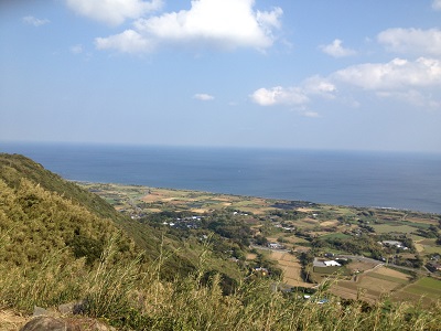
Picture - View of the
coastline and farmlands from the top of Mt. Tennyogakura.
Mt. Tennyogakura, 天女ケ倉, is one of the highest points on the
island at only about 238 meters high. At this spot, the view
of the coastline and adjacent farms is amazing. There is
also a small platform where you can observe the night sky if
you are so inclined. Be sure to put something on any of your
lightweight belongings, as the wind can get pretty strong up
here.
Most of the land use on the island is farming although a
decent amount is open space covered with natural vegetation
typical of a subtropical climate. Along with the usual scrub
type bushes, there is a wide variety of tall, thin trees
with canopies covered with leaves and thick vines. There is
also a fairly diverse mix of palm trees, banana trees, and more
flowers than you can possibly imagine, especially during
Spring. |
|
 Rock
Formations Rock
Formations
Tanegashima has some of the most beautiful rock formations
in Japan. Many outcrops extend into the sea and are topped
with trees and bushes.
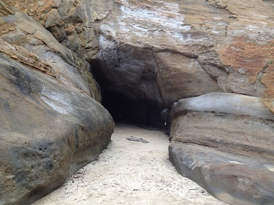
Picture - An entrance
to the famous Chikura Caves.
Many of these formations have been carved out over millions
of years by the forces of wind, waves, and rain, resulting
in fascinating caves. The most famous of these caves, known
as Chikura Caves, can be found at Hamada beach in Minamitane
town. The main area of the cave is so large it is said that
it can accommodate 1000 people at the same time.
The outcrops are made up of mostly sandstone and shale and
be incredibly beautiful on a bright sunny day, especially if
viewed from a good angle. Some of the sedimentary deposits
contain marine fossils of various ages. Many other fossils,
and a plethora of different seashells, can be found almost
anywhere along the Tanegashima coastline. |
|
|
|
|
|